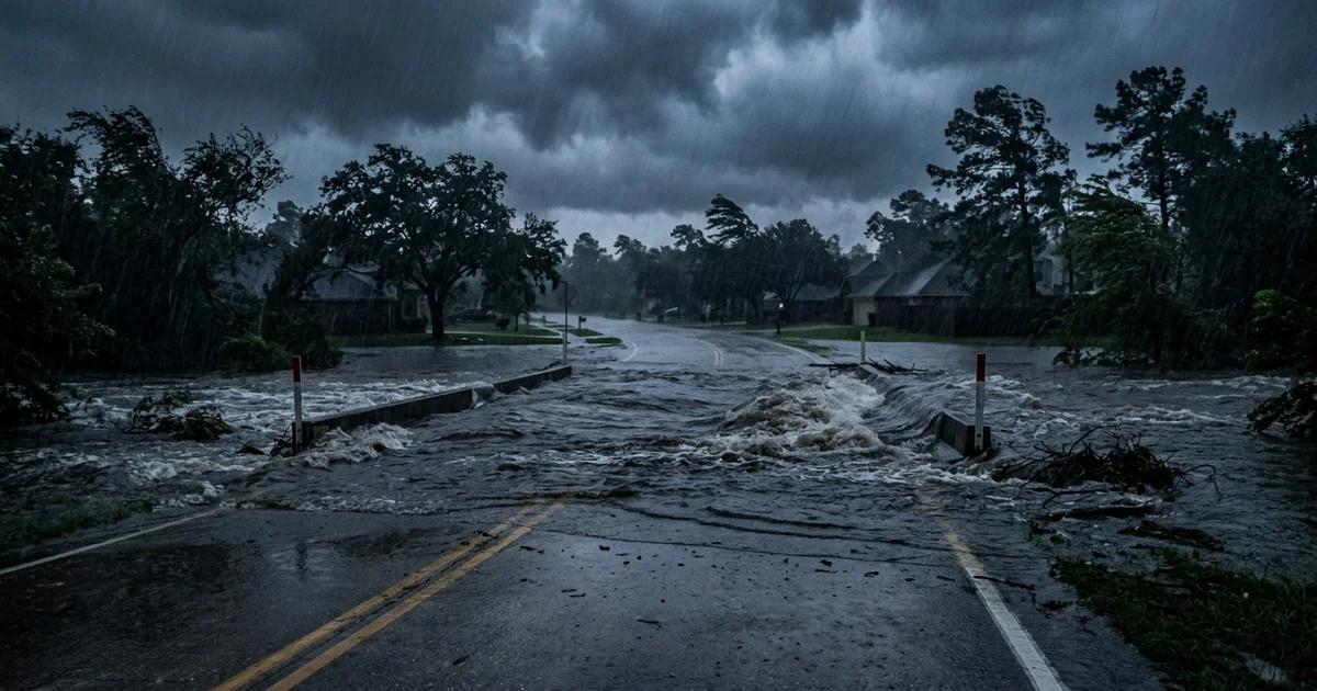
Central Texas is under flash flood warnings again, with the National Weather Service issuing alerts for Travis, Williamson, and Burnet counties early Monday morning as waves of heavy rain roll through the Austin metro area.
Round Rock, Cedar Park, Georgetown, Pflugerville, and Leander are all within the warning zone, and forecasters say the threat of life-threatening flash flooding will persist into midweek.
The Monday Morning Situation
The flash flood warning was extended through at least 7:00 a.m. CDT on Monday, with radar showing intense rainfall rates across the region. According to KUT, Austin’s NPR station, the warning covers a broad swath of the metro area, and low-water crossings throughout Travis and Williamson counties are at risk of rapid inundation.
Houston is bracing for its own round of severe weather. Forecasters have issued a flood watch for the Houston metro, with meteorologists warning that several inches of rainfall are possible over the coming days. The concern is not just the volume of water but the speed at which it arrives — terrain in Central Texas is famous for funneling rainfall into fast-moving floods with almost no warning time.
A Year After the Deadliest Floods in Texas History
The timing of these warnings carries an unavoidable weight. Less than a year ago, catastrophic flash flooding in the Texas Hill Country over the Fourth of July weekend killed more than 130 people in what became the deadliest flooding disaster in modern Texas history. The Guadalupe River tragedy reshaped the way Texans think about flood risk, but it did not change the physics of how water moves through this landscape.
Central Texas sits on a geological formation that is almost purpose-built for flash floods: thin soil over limestone, steep creek banks, and a river system that drains enormous areas into narrow channels. When rain falls hard and fast, there is simply nowhere for the water to go except straight downhill, as Newsweek reported in detailing the life-threatening potential of this week’s storms.
What Residents Need to Know
The core advice from the National Weather Service has not changed since last summer: turn around, don’t drown. Low-water crossings can go from dry to impassable in minutes. Barricades are there for a reason. If you cannot see the road surface, do not cross.
Austin Emergency Management recommends checking the Lower Colorado River Authority’s hydromet monitoring system for near-real-time rainfall totals. The city’s ATX Flood Safety program tracks low-water crossing closures and provides mobile alerts for residents in flood-prone areas.
The larger question — whether Texas has done enough since last July to prepare for exactly this kind of event — remains painfully unanswered. New flood monitoring stations have been added, and some warning systems have been upgraded. But the underlying vulnerability has not changed. The same terrain that has made Central Texas beautiful has also made it one of the most flash-flood-prone regions in North America, and this week is a sharp reminder of what that means in practice.