
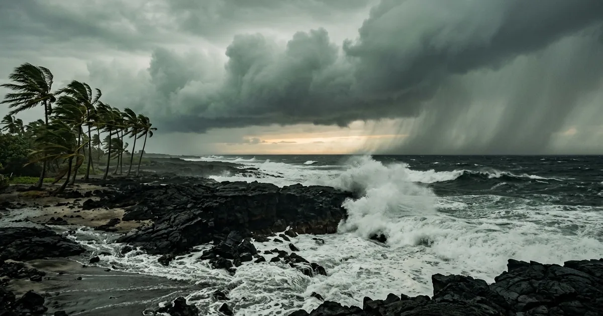
Lala was sitting 165 miles east-southeast of South Point late Friday night with 65 mph winds and a forecast that turns it into a hurricane over Hawaii Island by Saturday morning.
Hawaii has absorbed exactly two hurricane landfalls since 1959, which means the state is about to run an emergency playbook it has almost never had to use for real.
The National Weather Service has a hurricane warning up for Hawaii County, tropical storm warnings for Maui County, Oahu and Kauai County, a high surf warning through 6 a.m. Sunday, and flood watches stretched across the chain. Governor Josh Green’s assessment, delivered to residents on Friday, was four words long: “This is a very serious storm.”
What the Forecast Actually Says
The storm is moving west-northwest at roughly 13 mph, which puts its core near the southern tip of the Big Island on Saturday before it slides south of the smaller islands on Sunday. Forecasters expect it to cross the hurricane threshold, 74 mph sustained winds, right as it arrives.
That is a low-end Category 1, and the category number is the least interesting thing about this storm. Peak winds on the Big Island are forecast in the 40 to 75 mph range with gusts to 85 mph in Kona, the southeast, and the interior. Surf on east-facing shores is projected at 15 to 20 feet on the Big Island and 10 to 15 feet on Maui.
The Rain Is the Threat, Not the Category
Here is the number that should be driving decisions on the island this weekend: 10 to 20 inches of rain on Hawaii Island, with local maximums up to 25 inches. Maui is looking at 8 to 12. The rest of the chain gets 4 to 6, with isolated totals near 8.
Two feet of rain on volcanic terrain is not a wind story. It is a mudslide and flash-flood story, and it does not need a strong hurricane to happen. The Big Island’s geography stacks steep slopes against saturated ground and narrow drainages, and the worst outcomes in Hawaii’s recent weather history have come from water rather than wind. Hawaii’s emergency management agency has been pushing that framing since the warnings went up, and the Hawaii Tribune-Herald reported Friday that officials were treating the rainfall forecast, not the wind field, as the defining hazard.
By Saturday morning the outer bands had already reached East Hawaii, Maui County had opened temporary evacuation points, dozens of flights had been canceled, and the state had activated its Joint Information Center.
Two Landfalls in Sixty-Seven Years
The reason this is a genuinely unusual event, rather than another named storm on the tracker, is the historical record. Only two hurricanes have made landfall in Hawaii since the 1950s: Dot in 1959 and Iniki in 1992.
Iniki is the one people still measure against. It came ashore on Kauai on September 11, 1992 as a Category 4 with winds recorded at 145 mph, killed six people, and destroyed 1,421 homes, according to NOAA’s account of the storm. That is the last time the state took a direct hit, and most of the people living on the Big Island today have no adult memory of one.
Hawaii usually gets a pass for reasons that have nothing to do with luck. Cooler water east of the islands and persistent wind shear tend to tear storms apart before they arrive. Those defenses are weakening. Warmer sea surface temperatures give tropical cyclones more fuel and let them hold intensity closer to the islands, and CNN reported this week that Lala’s approach fits a pattern researchers have been flagging for years. “Rare” is a description of the past. It is not a forecast.
Why the First Seventy-Two Hours Belong to Hawaii Alone
There is a structural fact about Hawaii that gets lost every time a federal official promises resources are on the way. The nearest mainland staging ground is roughly 2,400 miles away. Everything that arrives, generators, water, personnel, heavy equipment, arrives by air or by ship, and the airports and harbors are exactly the infrastructure a hurricane closes first.
That geography means the federal surge model, the one designed for a Gulf Coast state where convoys can drive in from three directions, does not apply here. Whatever happens on the Big Island between Saturday morning and Tuesday is a state and county problem, and it is resolved with whatever was already staged on the island before the storm arrived. Hawaii’s own planning documents are explicit that the first 24 hours run on local capacity, with county damage assessments feeding the state agency before any federal request can even be written.
That is worth naming clearly, because the political conversation about disaster response in 2026 has been moving in the opposite direction. We made a version of this argument after Hurricane Melissa tore through the Caribbean, where the money showed up for recovery and almost none of it showed up for the years beforehand. The push to shift more preparedness and recovery responsibility onto states assumes states can absorb it. Hawaii received $4.6 million in FEMA preparedness funding this April, which is real money and also a rounding error against the cost of hardening an island chain. A state that has to pre-position everything, for every island, before it knows where a storm is going, is not a state that gets more resilient by being handed more of the bill.
What to Watch Through Sunday
The immediate markers are the ones that decide how this is remembered. Whether Lala’s core crosses land rather than grazing South Point. Whether the heaviest bands stall over the Hilo side or keep moving. Whether the rainfall lands on slopes that are already saturated. CBS News published the current track maps and the warning boundaries, and those boundaries have already shifted north once this week.
The longer question sits underneath all of it. Hawaii’s protection from hurricanes was always oceanographic rather than institutional, and that protection is thinning while the response capacity stays exactly as far from the mainland as it has always been. Lala may pass with flooded roads and a few thousand customers in the dark. The next one may not, and the planning window for that storm is open right now.