
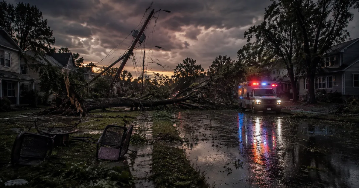
A wall of wind that the National Weather Service’s Storm Prediction Center formally classified as a derecho crossed roughly 300 miles of the Midwest on Tuesday, gusting to 99 mph at Gary’s airport and cutting power to more than 875,000 homes and businesses.
Three people died in the storm, and none of them was killed by the wind. Each one died a step downstream of it, in the space between a warning that arrived and a rescue that could not.
That gap is the actual story here, and it is the one that almost never makes the outage tally. The alerting machinery the federal government rebuilt after the last catastrophic derecho did its job on Tuesday afternoon. Everything the alert hands off to, the tree canopy over a bedroom, a gas main under a driveway, the road an ambulance needs, did not.
A Wind Event That Behaved Like a Landfalling Hurricane
Derecho is not a loose adjective for a bad thunderstorm. To earn it, a storm has to hold a damaging wind swath at least 250 miles long and 60 miles wide, a threshold Fox Weather spelled out as this one organized over Iowa and drove east. It cleared that bar with room to spare, carving from northeast Iowa through northern Indiana and into Ohio, then pushing damage as far as West Virginia and Virginia.
The wind readings read like a hurricane landfall report rather than an August afternoon in the Corn Belt:
- 99 mph at Gary Airport, Indiana
- 97 mph at Sugar Grove, Illinois
- 96 mph at Shorewood, Illinois
- Above 100 mph at Lansing, Illinois
Meteorologists at CBS News Chicago clocked a 126 mph reading at Tinley Park that had not been sorted into tornado or straight-line wind by evening, which is its own small illustration of how thin the distinction gets at those speeds. Survey crews confirmed two tornadoes in the Chicago suburbs, an EF-1 near Monee and Crete and a second near Oak Forest and Flossmoor, with a third radar-confirmed circulation in the south suburbs suspected to be stronger. Water came with the wind. Dayton set a daily rainfall record at 2.07 inches, breaking a mark that had stood since 1915, and parts of northern Indiana have absorbed roughly 10 inches since Monday afternoon.
Three Deaths, and the Pattern Nobody Puts in the Headline
In Geneva Township, about a mile and a half northwest of North Vernon, Indiana, a tree came down on a house. Jennings County dispatch took the call around 3:30 p.m., and WISH-TV reported that Deputy Chief Cody Low confirmed a 4-year-old was trapped inside and did not survive. The child was indoors, away from windows, which is precisely what every alert instructs a family to do.
Up on the Lake Michigan shore in Portage, one person died in a house explosion and fire as the line moved through. Police said at a Tuesday evening briefing, reported by CBS News Chicago, that there had been gas leaks across the city, and that their own response to the explosion was slowed by debris and hazards in the streets. Mayor Austin Bonta declared a local state of emergency.
Then Ohio. A resident of Roseville, a village of about 1,500 people in the Perry County flood zone, had a medical emergency and died because responders physically could not reach them. Gov. Mike DeWine said the water had left one passable road out of town and put the National Guard’s High Water Rescue Unit on the move, with an evacuation shelter opening in nearby Crooksville.
This was an individual who died simply because they had an emergency and they could not get to that individual.
Read the three together and the common factor is not wind speed. It is the built environment converting weather into lethality: a tree with a house under it, a gas line snapped by roots or falling limbs, a road network that becomes a moat. Two of the three deaths involved emergency responders who knew where to go and could not get there. That is a distribution and access problem wearing a weather costume, and it is the same shape as the deaths in New York’s basement apartments during last month’s flash floods, where the fatal variable was the housing stock rather than the rainfall rate. It rhymes, too, with the Guadalupe River flash flood emergency in the Texas Hill Country, where getting to people was the hard part long after everyone understood the water was coming.
The Alert on Your Phone Exists Because of August 2020
Here is the part that makes Tuesday genuinely awkward for anyone who treats warning technology as the fix. In August 2021 the National Weather Service added damage threat tags to severe thunderstorm warnings. A storm tagged “destructive,” meaning 80 mph winds or hail at least 2.75 inches across, automatically fires a Wireless Emergency Alert to every phone inside the warning polygon, the same intrusive buzz reserved for tornadoes and AMBER Alerts. Only about one in ten severe thunderstorms nationally reaches that category each year, and most that do are damaging wind events exactly like this one.
The agency built that tag because of the August 2020 derecho that flattened Iowa, an $11 billion event and the costliest thunderstorm in United States history, which produced hurricane-force winds under a warning product that could not legally interrupt anyone’s afternoon. Tuesday’s storm cleared the destructive threshold by 19 mph at Gary alone. The alert existed, it fired, and sirens sounded across the Chicago suburbs for straight-line winds strong enough to strip roofs.
So the last mile to the phone is solved. The last mile to the door is not, and it is a far more expensive problem, because fixing it means money for vegetation management around distribution lines, gas infrastructure that fails safe when the ground moves, and road and drainage systems that keep ambulances moving during the exact hour they are needed most. None of that ships as a software update, and none of it produces a press release about a lifesaving new alert.
Roughly a Million Dark Meters, and What They Say About the Grid
By Tuesday evening the tally across Illinois, Indiana and Ohio had climbed past a million customers, with Indiana absorbing the worst of it at about 370,000. The composition matters more than the total. CBS News Chicago tracked NIPSCO above 300,000 customers out by 5 p.m., roughly 60 percent of its entire 500,000-customer service base in a single afternoon, while ComEd’s 234,000 outages represented a much smaller slice of its 4.1 million meters. Schererville, Indiana lost power as a whole town, and police there told residents to stay put and stay off the roads. Ohio ran about 290,000 in the dark and West Virginia added more than 33,000, according to the Associated Press account carried by PBS NewsHour.
Aviation folded on cue. Ground stops hit both O’Hare and Midway, and weather.com’s live coverage tracked more than 200 cancellations and 700 delays at O’Hare before the stops expired. In Tinley Park the new i80 Sports Dome was left flattened and the Credit Union 1 Amphitheater took damage, the sort of large-span structures that tend to fail first and photograph best.
What Comes Next Is More Water
The wind has moved on. The water has not. Forecasters have the Ohio Valley under a flood threat into Friday, with widespread totals of 2 to 3 inches and a corridor from Indiana into West Virginia in line for 3 to 5, all falling on ground that has nowhere left to put it. DeWine put it plainly on Tuesday: this is not something that will end tonight.
Which raises the question worth carrying into the next one of these. The federal government spent the years after 2020 making sure a derecho could reach into your pocket and interrupt you, and on Tuesday it worked exactly as designed. The three people who died were not short on warning. They were short on a tree crew, a gas main that held, and a road an ambulance could drive down. Whether the next round of investment goes to the alert or to the things the alert hands off to is a budget decision, not a meteorological one.