
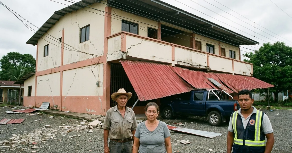
A magnitude 7.7 earthquake struck Panama’s Azuero Peninsula at 12:56 p.m. local time Friday, and by mid-afternoon the two questions leading the coverage, the tsunami and the canal, both had comforting answers. The people with the most to lose were never part of either question.
“It’s just the two of us old folks here. The house has cracked, and we’re afraid it could fall on us.”
Ricardo Brown, Las Minas, Herrera province
The tsunami threat is over. The Pacific Tsunami Warning Center’s final message on the quake declared that it “has now passed,” 48 minutes after forecasting waves of one to three meters for parts of Panama’s coast.
The canal is fine, too. Reuters put that in the headline.
The shaking went somewhere else. The USGS loss model, PAGER, issued a red alert for economic losses and notes that past events at that level “have required a national or international level response.”
It also names the buildings most at risk in the region: unreinforced brick and adobe.
Here is where the USGS shaking estimates put the hardest hits, on the Modified Mercalli scale:
- Severe (VIII): Tonosí and Llano de Piedra, small towns in Los Santos province.
- Very strong (VII and up): Macaracas, Pedasí, Las Tablas and Ocú, plus the provincial capitals Santiago and Chitré, each home to roughly 46,000 people.
- Moderate (around V): the Panama City area, which is why the cameras found evacuations instead of rubble.
We added up the model’s exposure tables. About 42,000 people sat in the severe and violent bands, and another 444,000 felt very strong shaking.
PAGER’s fatality alert is a lower yellow. The same model still gives roughly one-in-three odds that the death toll reaches 100 or more.
Early ground reports fit that map. Panamanian broadcaster Telemetro carried reports of collapses across Azuero, with the beach town of Cambutal, near Tonosí, described as the hardest hit and its roads affected.
Omar Smith, who heads Panama’s civil protection service, said the damage was concentrated in Veraguas, Herrera and Los Santos.
Seventy miles from the epicenter, in Penonomé, the tower of the Cathedral of San Juan Bautista came down, along with part of the Hotel Dos Continentes facade. The governor’s office was damaged as well.
USGS classifies the rupture as left-lateral strike-slip, sideways motion that typically lifts little seafloor, which fits a tsunami that never showed up. It was also shallow, about 13 kilometers down, and shallow is what turns a big number into broken walls.
More than a dozen aftershocks followed, the largest near magnitude 6.
As of mid-afternoon in Panama, no deaths had been confirmed. We think that line deserves suspicion, not relief, because in a rural quake the first hours of “no deaths reported” mostly measure how far the reporters are from the damage.
We have watched both halves of this story play out since summer. In August, Colombia’s 7.4 left the remote Chocó department with the worst of it. That same month, a 7.7 off Flores brought a tsunami warning, a long wait, and water that never came.
Panama’s government should send its assessment teams to the towns on that list first and publish what they find, town by town, before an empty casualty column hardens into the story that Panama got lucky.
The aftershock count will keep climbing. The number that decides how bad Friday was is how many adobe homes in Los Santos are still standing when the inspectors arrive.